Fish breeding ponds are mentioned in Pool in documents of the late 12th century, situated alongside what was “possibly the major route along the southern side of the Wharfe valley connecting Skipton with Harewood via Ilkley and Otley” .(WYAS, Leeds Library AD 1500)
Pool is being rapidly modernised, a haunt of anglers and a stopping place for motor-men and cyclists
Edmund Bogg’s Descriptive Guides c. 1900

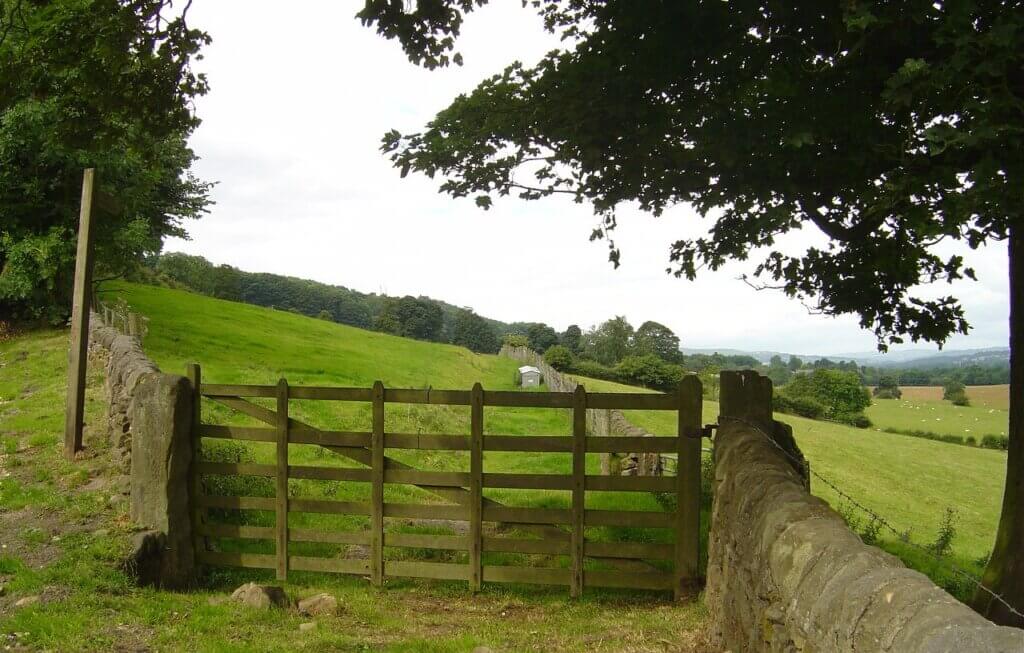
CALEY LOW ROAD, runs from opposite Overdale Manor and is now no more than a track but is still a public footpath to Caley New Hall and Caley farm through to Otley. This was marked as a road on the Award map of 1774 and ran via Caley and the now demolished 16th century Caley Hall. (on a map of 1756.) to Soldiers Fields to emerge on East Busk Lane, Otley. When it reaches the outskirts of Otley it is called Foul Causeway Lane. When Caley is passed another track goes right to Otley Road and Knotford Nook, which served Knot ford. A line of hawthorn hedges supported by a low wall can be seen in the field opposite Sandy Lobby running towards Caley. This will have been built to stop livestock from wandering. Probably built in 1820. The owner of Caley Hall at the time, Dr. John Raistrick made the crags and his land to the south into a deer park.


LODGE LANE or “Sludge Lane”, on a map 1756 and named Occupation Road on a map of 1902. This track is still there serving Jane Whiteley Homes and runs between Church Lane and St. Wilfrid’s church. In 1849 this was to be used by Pool House when deeds state ”a right of road too and from the stable, coach house and too and from the ash pit (for the purpose of emptying same and too and from the highway)”. The road in 1756 had a township gate at the entrance near St. Wilfrid’s church, which was possibly another entrance to the Caley Deer Park, Caley Lodge and Caley Hall, hence the name of Lodge Lane. The lane ran from the side of St. Wilfrids Church running up the hill joining with the above track to Caley and Otley – the stone gate posts can still be seen where it joined Old Pool Bank. Both tracks can also still be seen. On a map of 1756 roughly in the area of Church Close was a field called Rise Bridge which means a road through marshland prepared with brushwood. These tracks would possibly be used when the ancient road to Otley was wet and impassable also before the Leeds Road (A660) to Otley was built in 1841. (for Caley Hall, see “Houses pre 1850″also “A Brief History”)
PACK HORSE/ CARRIAGE TRACK came down from the Chevin and joined at Caley, crossed over Otley Road, then to the river crossing at Knotford Furr, now known as Knotford Nook. The iron gateway to this can still be seen on the main Leeds Road, the second one, below Cragg View cottages lead to the now demolished Glen Royd, home of the Whitaker family, Pool Quarry owners.
A RIVERSIDE FOOTPATH is shown on the O.S. map of 1847 & 1851 running along the south side of the River Wharfe from Pool to Arthington.


ARTHINGTON LANE and OTLEY ROAD. This ancient route was known as “The King’s Highway” in 1309 (Don Cole). The earliest reference to these roads is in the late 1100’s when Manorial Fish Ponds are mentioned alongside the route from Skipton to Harewood. “ the medieval routes which led out of the village, possibly the major route along the southern side of the Wharfe valley connecting Skipton with Harewood via Ilkley and Otley” (West Yorkshire Archaeological Survey to AD 1500). In 1120 a marriage took place between Cecillia Romille and William de Meschines when this road would have connected their Skipton and Harewood Castles.
Otley Road (incorrectly referred to now as Pool Road) ran through low lying marshy land and was often impassable in winter time. It may be that then that the higher route which passed through Caley, Caley Low Road and Foul Causeway Lane, would have been used to reach Otley. Arthington Lane was known as Poole Lane in 1674 (Boundaries of Poole by Everyld Thornhill Lady of the Manor in 1674)
By the mid 1700’s the road became so bad that an act of Parliament described it as “ruinous and bad… that in the winter season it is impossible for wagons or other wheeled carriages to pass along the same and very dangerous for travellers”. So on 12th Feb. 1753 work began to erect toll-bars in an effort to collect money to repair the roads which would hasten traffic from Otley to the Great North Road at Tadcaster. (see Toll Bars and Pool Toll Bar Riots). Two old Toll Bars can still be seen. Pool Bank Chain Bar at the top of Old Pool Bank built in 1847 and the other the Bar House on Arthington Lane, c. 1750, both now private houses.
“Several cross roads were listed in directories of the early nineteenth century also York to Carlisle by Tadcaster, Skipton and Kendall, passing through Arthington, Pool and Otley.” (The Postal History of Upper Wharfedale” by Ronald Ward.)
“Timble Man” by Ronald Harker. “1908 May 16th. To Pool to see Mr. Tankard and walked back (to Timble). Immense number of cyclists and motor cars passing. The dust nuisance will be awful in dry weather. Something will have to be done about it.”
In 1912 the majority of the village roads are laid with tar. (PPC Minutes). This was to replace the roughly broken limestone.
Holmes Whiteley recalls that in the early 1900’s, “before the road was properly surfaced, whenever a vehicle came passed a large white dust cloud went twenty feet into the air. It took a long time to settle and when it did, it left a white film on all the hedgerows.”
He also recalls “There were no plus-four men from Wakefield to inspect the work, all the supervision received was when the boss came with the workmens’ wages once a fortnight. He measured their work by putting a chalk mark on the wheel of his trap and counting the number of turns from the place he saw them last”.
In May 1926 the widening and straightening of Otley Road began. This took out the bad bend at Knotford Nook. It became known to the locals as “The Straight.”
Otley Road is often referred to as Pool Road, however it was confirmed by Pool Parish Council in 2002 that from Pool, Otley Road runs as far as Knotford Nook when it changes name to Pool Road running towards Otley.

In an attempt to relieve traffic congestion near the Shell garage, this “new island” was built on Otley Road in 1953.

ARTHINGTON VIADUCT was originally called “Wharfdale Viaduct” and by the workers as “Wharfe Viaduct.”
Building was granted by Parliament in 1846 when it was estimated by the Chairman of the Leeds and Thirsk Railway that the quantity of stone used would exceed 50,000 tons. The stone was supplied by James Bray who operated Pool Bank Quarries. There are twenty one arches, each with a span of 60 ft. The length of the viaduct is 1,510 feet with a road width of 30 feet. This picture would have been drawn to attract investors prior to building, shows various stages of intended development. The last arch was keyed in during July 1848. Some workmen/subcontractors were Garside, Parker and Oldroyd, with William Greenwood, a stone mason. (documents). 20,000 men and 300 horses were employed in the tunnel and viaduct project.
Bradford Observer 2nd April 1846 “Wharfdale Viaduct of the Leeds and Thirsk Railway. – The ceremony of the laying of the first stone of this great work took place on Monday last, amidst an immense concourse of people, gathered from the vallies of the Aire and the Wharfe. The day was remarkably fine, and the proceedings were of a very animating character. From an early hour in the forenoon, the air resounded with martial music and the roar of cannon; and every road leading to the scene of this interesting ceremony continued to bring large numbers to the crowd. The nice little village of Bramhope too, – with its newly built wooden huts, presenting the appearance of a “new settlement” in an old and richly cultivated district and giving a “local habitation and a name” to scores of adventurers, who seek to supply the various wants of a new influx of strangers – gave up its crowd of railway labourers to add to the picturesque effect of the stirring scene. At one o’clock, a large procession, in which were the directors and other gentlemen with a goodly sprinkling of the gentler sex, started from Pool, with bands of music, and colours flying, and coming down to the river, the procession crossed over to the north side by means of a temporary wooden bridge. The stone was laid by H. C Marshall, Esq, the chairman of the company, who was presented with a silver trowel and beautiful mallet for the occasion. The stone being deposited and the ceremony over, the workmen were regaled with ale and edibles, and the directors and their friends, invited by the contractors, partook of a rich collation a the hospitable hotel of Mrs. Beanland, at Pool (the White Hart) We may add that the works on the Bramhope contract are proceeding most favourable, so much so that Mr. Bray calculates on being able to complete them six months sooner than the time specified in the contract. The strata found in the tunnel are easy; and to Mr Bray the stone will prove most valuable and profitable, affording sufficient to build nearly all the viaducts, bridges and mason work along the line.” (see “Arthington Viaduct”)
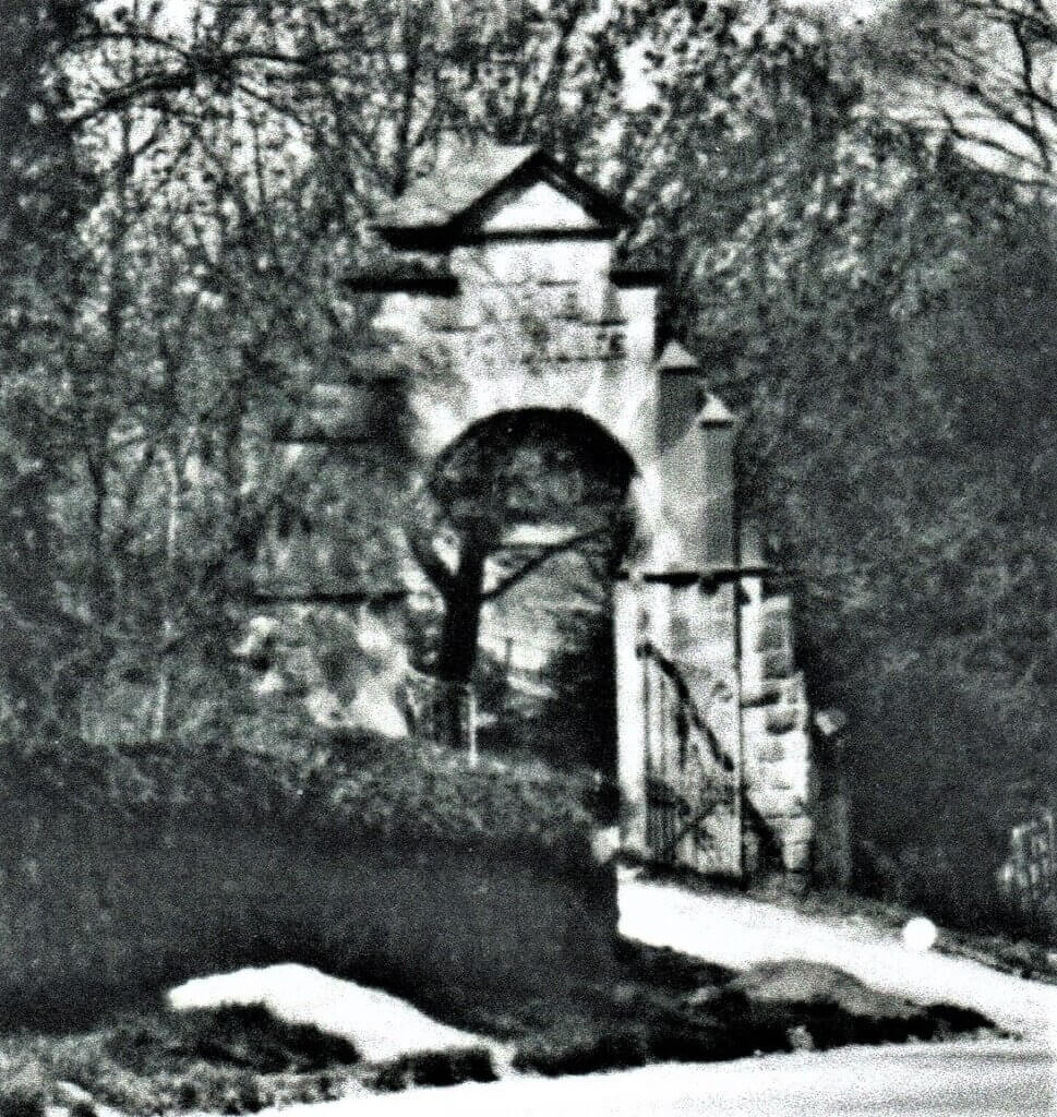
AVENUE DES HIRONDELLES. The name of this road was given by Mr. Tom Swallow, who lived at Troutbeck, Arthington Lane. He built three houses on this avenue c.1900. (SHP). His daughter was born in France and hirondelle is the French for swallow. According to a map of sale of property by Whitaker’s quarry, he already owned some of the land in 1899. The ownership of some of his land passed through the old Pool Bank quarry. A path, the extension to the Avenue, still leads to the quarry. His original intention was to extend the Avenue to Leeds Road, but the water supply could not be pumped up from Pool-in-Wharfedale Waterworks, higher than the last house erected which was about one third of the intended route. There is a grand arched stone entrance, originally with an iron gate, to this road bearing the name “Avenue des Hirondelles” which was slightly damaged in 2008 during the re-roofing of the telephone exchange and again through the falling of a tree during the bad winter of 2010/11. The wrought iron decoration was removed for protection by a nearby resident. Because of its many horse chestnut trees was known by local lads as Conker Avenue. The road is also a public footpath leading the old stone quarry.


BOUNDARY STONE. A 19th century boundary stone is on Arthington Lane where Pool Beck (or Kirskell Beck) separates the parishes of Pool and Arthington. In May 1873 Arthington Parish Council record “The extent of Roads in the township of Arthington is liable to repair”. In the early 1800’s this beck did not have a bridge and travellers would drive their stage coaches, horses, livestock, etc. through the water. (Darwin notes of c. 1850) This stone was renovated by the History of Pool Group in 2008.

BRAMHOPE TUNNEL The building of the tunnel was begun in 1846. Though original records are that 23 men lost their lives, further study has revealed there were many more. A grave resembling the entrance to the tunnel is in Otley churchyard to commemorate their deaths. There is a fine castellated entrance at the Arthington end of the tunnel, Grade 2 listed. Pool Quarries supplied the stone for both the viaduct and to line railway tunnel.
In later years the men who worked there would wear mole-skin suits to keep them warm and would emerge with icicles hanging from their helmets, they would be in there all day or night. They would always tie string round the bottom of their trousers to keep out the rats! One of their main duties was to knock down the large icicles hanging from the roof so they did not damage passing trains. They would build large fires in braziers under the outlet chimneys to melt the icicles and keep themselves warm. (Mrs. Webster whose father and grandfather Raine, are shown on the photograph ).
During WW2 in one turret on the north entrance, which had been the home of railway workers, a guard was posted by the War Department. During the war a bomb was dropped, just missing the railway line on the north side, the only damage was one or two dead cows. Prior to this the villagers would shelter under the viaduct during an air-raid, after the raid this was discontinued! (See also “Arthington Viaduct”)
10th Sept. 1880 Arthington. Venerable Villager. “Christine Clapham familiarly known in the village as “Mother Clapham” still resides in a cleanly and very neatly ordered thatched cottage on the roadside between the railway arch and Arthington. She was 90 years of age last July.” She kept a lodging house for many of the navvies during the making of the Bramhope tunnel on the Leeds, Thirsk railway line.(Wharfedale Observer.)
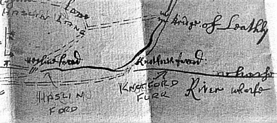
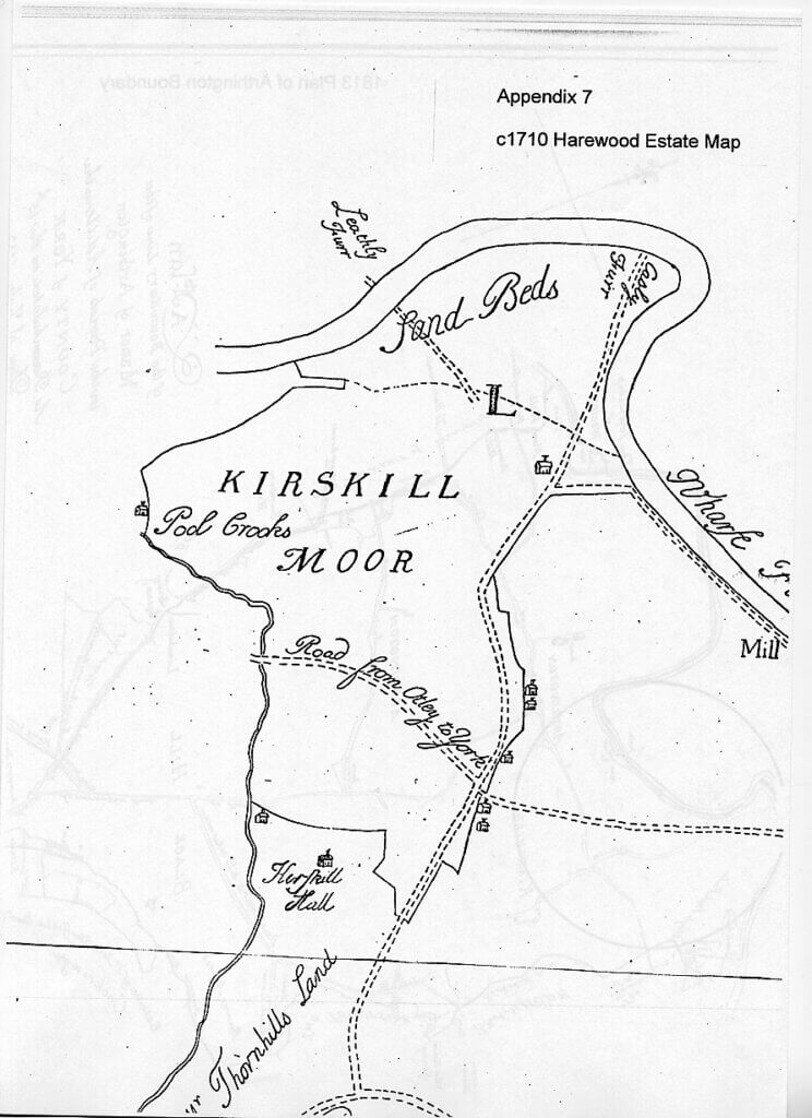
FORDS Local crossings of the River Wharfe were made at Haslin Furr & Knotford Furr (Knotford Nook on Otley Road); also at Haldwadford (Medieval name) also named Leathley Ford and Castley Ford, both crossing from Arthington to Castley.
The Harewood Estate Map c.1710, above, names them Leathly Furr and Casly Furr. Haslin Ford was west of Knotford Nook. Farnley Estate map shows this Ford linking Pool Road with Farnley Estate.
According to WYAS an ancient ford was at Pool. This seems to be born out by the fact the field north of the Wharfe, immediately east of Harrogate Road is named on O.S. map 1847, “Rotherford” (Rother is Celtic for “chief river”).
LOW LANE is no longer recognised as a road, but the census of 1871 indicates that it ran alongside Troutbeck when occupied by Child, a dental surgeon. This was probably a track connecting to the original Staircase Lane (named Bramhope Road in 1700’s) which ran down from Oakdale to the river. (see also Ribbon Lane)
LEEDS ROAD. In 1841 a new route to Otley from Leeds was built via Pool Bank called the Leeds – Otley Trust Road (A660). It was built by a board of some 100 trustees of whom Michael Nicholson of Nicholson & Co. (now Weidman/Whiteley) Pool Low mill owner from 1809 and earlier Pool High Mill or Pool Fulling Mill, was one. Paul Garnett, Ayscough Fawkes and William Ackroyd were others.
On 22nd Feb. 1851 a report was issued on the state of the Leeds and Otley Turnpike Road which stated “Poole – very bad”. The report covered Leeds, Headingley, Adel, Cookridge, Breary, Bramhope, Poole and Otley. “In nearly every Township we had to complain that the Stones were not broken small enough in many cases, particularly in Poole, heaps of broken and unbroken stones, as well as Scrapings and Rut stones, were very improperly left so as to endanger Passengers.”
At the expiration of the Trust on 1st Nov. 1873 notice was given that it was the intention to sell the Toll-house, known as Pool Bank Chain Bar, top of Old Pool Bank road. It was later sold for £50. (see Turnpikes & Toll Bars.)
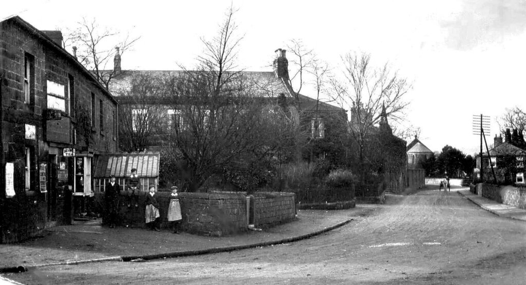
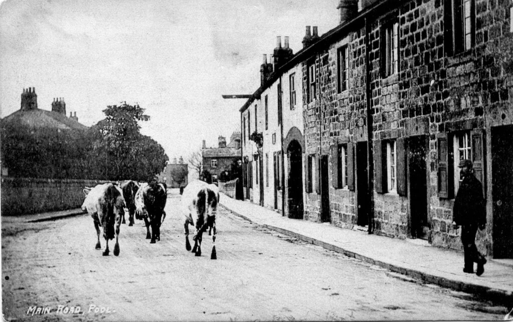
MAIN STREET As mentioned above, The West Yorkshire Archaeological Survey to AD 1500 held in Leeds City library states that “this, one of the medieval routes which lead out of the village, possibly the major route along the southern side of the Wharfe valley connecting Skipton with Harewood, via Ilkley and Otley”.
Very little had changed since the above photos were taken until the arched entrance and the Half Moon Inn on the right, with cottages to the north were sold in 2021 and converted to homes. Changes also began to take place at the release of land when The Manor of Pool was sold in 1902 and the sale of the Milthorp/Nicholson land a year later, it was then more building began along the street. i.e. Wharfe View, Chevin View, both built around 1906, soon to be followed in 1909 by the Pool Wesleyan Methodist Chapel.
Over the years the road surfaces in the village had been made up of roughly broken limestone which several records show that when motorised traffic arrived, threw up large clouds of white dust settling everywhere….. houses, hedgerows and people! They were not covered by tar until 1912 when some of the tar ran down from the bridge into the River Wharfe, killing many fish.
In 2009 the Leeds City Council confirmed that much of the old village was to be designated a Conservation Area stating, “Pool-in-Wharfedale is a place of special character and historic interest”

MILEPOSTS.
Mileposts began to be erected in 1820 with Mounting stones around 1758.
1.Grade ll listed. Milespost above (outside Weidmann/Whiteley gates, Otley Road) 1/166 ID: 438109
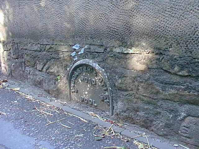
2.Part of milepost to east of Pool on Arthington Lane, low down, both dated c. 1820.
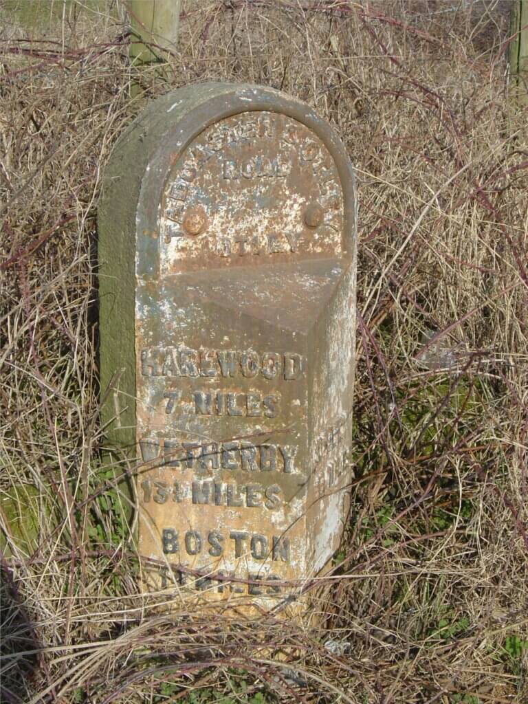
3.At Knotford Nook on the old road, (2nd telegraph pole on left from Otley.)
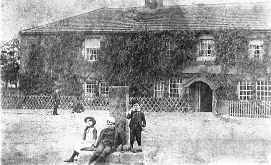
4. Maps suggest a milestone stood at the junction of Arthington Lane/Pool Bank New Road/Main Street. The “market cross” was removed c.1910 when motorised traffic found it difficult to negotiate. The actual post appears to now stand alongside Pool House gateway on Main Street
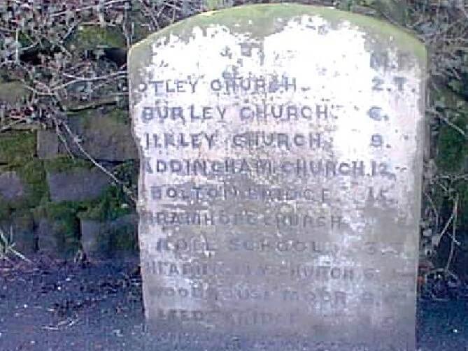
5.Milepost on South West Corner of Junction with Pool Bank New Road, St Se 241440 ID:1261798
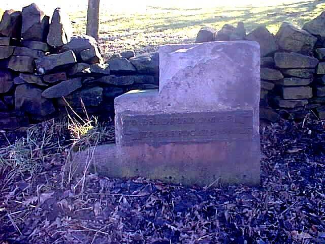
6.The milestone at the Dyneley junction was also used as a “mounting stone” to assist when mounting your horse. These were often placed a mile apart when a ride and tie system was used – one man rode for a mile whilst his friend walked. They changed places after a mile. (There was a similar milestone near Chapel Row, which measured a mile from the Dyneley). It is marked “Bradford – Harrogate”. The next mounting stone can be seen, measuring a mile away, is towards the airport.
MILL LANE. (previously known as Corn Mill Lane) leads to the old water corn mill, which according to a survey made by the West Yorkshire Archaeology Service in 1992, has medieval origins. Around 1300 the mill was owned by the Nuns of Arthington. (WYAS Corn Mill survey ) This lane therefore will have been used in medieval times. Later in the 1930’s the Lane served as a route to a rubbish tip which was next to the old corn mill. filling up the area known as the Yellands, meaning sloping land.
MILL LANE TO ARTHINGTON LANE FOOTPATH. This path emerging at Bar House, originally connected to the corn mill, diverted half way down to allow building of Millcroft housing estate. Originally with a stile, renewed in 1913.

OAKDALE DRIVE off Arthington Lane is a continuation of the ancient track which came down from the holloway of Staircase Lane (formally known as Bramhope Road) after splitting near the old railway track at the old barn, called Hardy’s Lair, and from Ribbon Lane (now under Redrow Estate. Shown on 1756 map) This track again is shown on the map of 1847 as then running to the river again splitting to Pool and Arthington. An old oak tree stood at the entrance which was felled in 2011 against the wishes of the rest of the Drive. The tree rings were inspected where it was found to have been over 300 years old. (Confirmation of ancient route see “Staircase Lane” below.)
OLD POOL BANK (road) May well have been used in Roman times. This would have connected with the Roman Road which ran through Carlton. A flint (possibly Neolithic, now in Otley Museum) was also found in 2000 in the field east of Swiss Cottage. Old Pool Bank (road) which is shown on the map of 1756 as Bradford Road. The Award Map of 1774 shows “road to Bradford” with a “turnpike bar” at the bottom left of Old Pool Bank Road connecting then with Ribbon Lane (shown on 1756 Map below) The Pool Chain Bar was built at the top of Old Pool Bank after the A660 road was built in 1841.

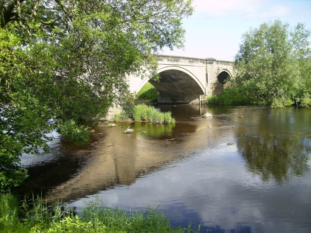
POOL BRIDGE. Grade II listed building. In 1752/3 the construction began of the building of the new turnpike road from Dudley Hill to Killinghall via Pool. (W.Y.A.S.) The first bridge over the River Wharfe was in 1754. (J.Bigland. “Topographical & Historical Description of the County of York” 1819.) This is shown on Thomas Jeffery’s map of 1775, surveyed 1771-72 shows, as does our Creskeld map of Pool dated 1756. This replaced a ferry at Pool (History of Harrogate & Knaresborough – Jennings). There was also an ancient ford believed to have been called Rother Ford as the field name on old maps suggest. (“Rother” is the Celtic name meaning “chief river”)
“We have no details of this earlier bridge and it is possible that part of this structure was incorporated into the ‘new’ bridge that was completed in 1801. It was built under the supervision of Bernard Hartley(the First) who was appointed Surveyor of Bridges to the West Riding in 1797, a post which he retained until his death in 1834.” (WYAS)
In 1817, 1819 and 1821 meetings of the trustees of the Turnpike Road from Dudley Hill to Killinghall were held at the house of Mr. Samuel Stead, the Half Moon Inn. At the meeting of 1819 it was proposed that a Side Bar Gate or Chain would be placed at the end of Leathley-Bridge across the road leading towards Otley (for other proposals see Leeds Mercury”)
Architectural Historian Peter Thornborrow gives his description below in 2005:
The listed building description suggests that the bridge is “18th century, widened in 19th century.
Pool Bridge was a new bridge (no bridge at Pool is mentioned in the County Book of Bridges of 1752) apparently built following an Act obtained in 1793. This stated that “there shall be a convenient bridge for carriages, erected over the R. Wharfe at or near Pool, and the road repaired from thence over the west side of a field called Becklands, from the village of Leathley”. This would take the earlier turnpike road from Dudley Hill & Killinghall to Harrogate established in 1752/3 (the same date as the Bridges Book).
Map evidence shows that there was no bridged crossing at Pool in 1720 (Warburton’s Yorkshire map), but there was one by 1775 (as shown on Thomas Jeffery’s map of 1775, surveyed 1771-72), with a toll-gate immediately to the north of it where the road divides to Leathley, to the west, and Castley to the east, where there was an ancient ford. Documentary evidence supports the existence of a bridge in 1754: ““At Pool, a pleasant village near three miles from Otley is a handsome stone bridge over the river, built by subscription in 1754 (Biglands “Yorkshire”) The existence of this bridge is confirmed by an estate map of 1756 that shows a bridge with three arches (held at Creskeld Hall, Arthington).

The W.Y.A.S in Wakefield have original plans of both bridge and extension, also coloured drawing. See also Pool Conservation Area.
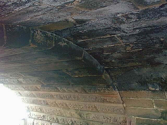
However, some 60 years later the bridge appears to have been inadequate for its traffic flow. In July 1812 Bernard Hartley produced a plan for alterations to the bridge to raise the parapet so that it was 4ft 2” above the road surface, and to widen it. The road surface too was proposed to be raised some 3 ft at each end of the bridge that was to be widened 13 ft, forming an entirely new bridge (joined to the earlier bridge) with a new elevation on its up-stream side. This would have had the effect of reducing the gradient for the better convenience of carriages and carts travelling over the bridge.
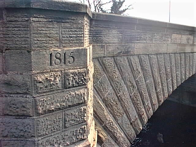
The date of the widening in 1815 is on the outside of the bridge. Evidence can also be seen from under the bridge. The west side of bridge is the newer side. In the later 19th century a 4” water-main was proposed to be carried across the centre of the bridge, fairly close to its surface (Leeds Corporation Water Works, Pool Water Supply: WYAS–QD3/263), supplying the village with ‘town water’.
A map of 1756 shows a township gate at the entrance to Pool near the bridge. An act of 1793 states “there shall be a convenient bridge for carriages erected over the River Wharfe at or near Pool and the road repaired from thence over the west side of a field called Becklands from the village of Leathley” . (WYAS)
During the late 1800’s a rare fern was discovered under the bridge structure a Ceterach officinarum – a scale fern. (H.S.) It grew there for year after year. Water bats were thought to roost here in the 1990’s
In 2002 an Ilkley historian suggested that this road was one of the earliest specially made roads to be made in the country.
J.Bigland’s “Topographical & Historical Description of the County of York” 1819.) says “At Pool, a pleasant village near three miles from Otley, is a handsome stone bridge over the river, built by subscription in 1754”.
A name and date “J.R. Ridelagh 1860” is near the indented top part of the bridge. It is an old family name, still in Pool today. Was it of a stonemason or a young boy’s “graffitti”? John Ridelagh is recorded as a quarry man on the census of 1871, aged 36.
When the Harrogate Road and through the village was finally surfaced in 1912 (it had just been white dusty limestone gravel) it was sprayed with tar, which ran into the River Wharfe and killed many fish.
During the 2nd world war, tanks and armored vehicles were brought too and from Farnley military camp and Riffa, over Pool Bridge to Pool-in-Wharfedale railway station. It is thought the tanks were at one time were en-route for the Normandy Landing, making the road through the village very busy, so much so police were called by the Parish Council to escort children across the road to school.

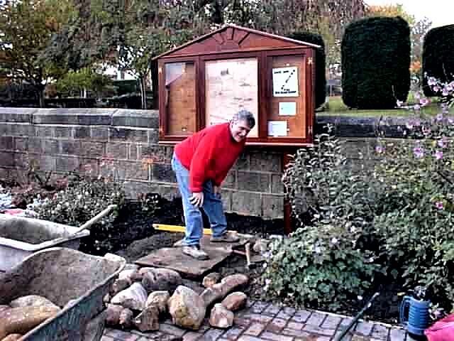
Strengthening of the bridge to comply with E.U. regulations, took place in 2002 when a temporary Bailey bridge was used whilst the bridge was being strengthened. This was to allow 44 ton lorries to use it. During this work stone cobbles were found on the older east side of the bridge only. Some of these cobbles are now laid under the notice board with a copy of an old map in the War Memorial Gardens.
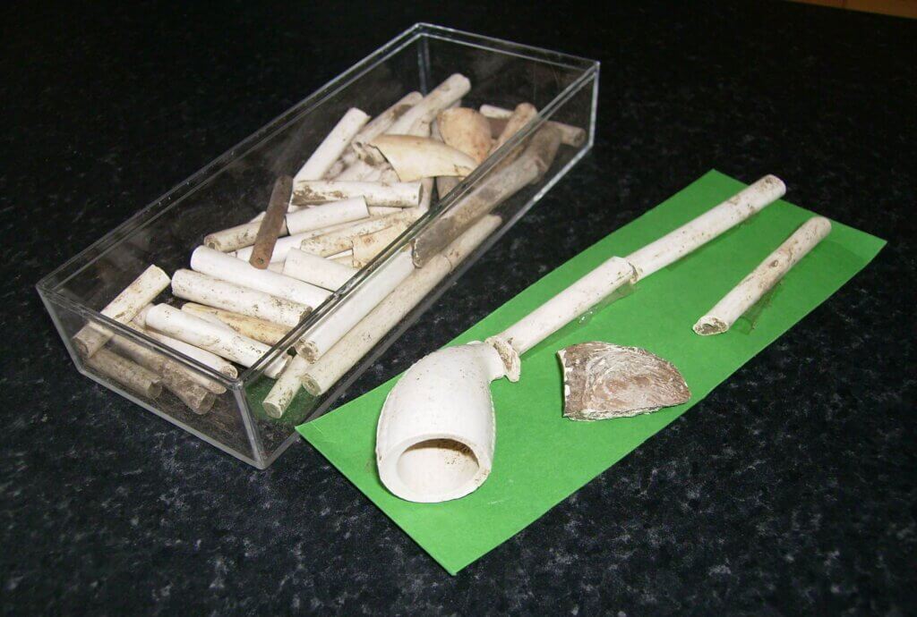

7th May 1886. Otley Police Courts. A Drunken driver – Anthony Webster of Pool for being drunk while in charge of a horse and cart on Pool Bridge on the 9th of the present month at a quarter to eight o’clock at night. Was fined 10/-d. and costs.

POOL BANK NEW ROAD. Roads began to change Pool around 1753 when a bridge was built over the River Wharfe. In 1816 a new easier route to replace Old Pool Bank and Staircase Lane was found down Pool Bank and the present Pool Bank New Road was built. The bridge was widened in 1815
Leeds Mercury 10th October 1807. Turnpike Road from Dudley Hill to Killinghall. “WANTED Two Surveyors, upon the Turnpike Road from Dudley Hill to Killinghall and the south west corner of Harrogate Inclosure, the one to survey such Didlet or part of the road as lies from Pool Bridge to the northern extremities thereof and the other from Pool Bridge to the southern extremity or the field road. Such surveyors, it is expected, will be fully competent to the making and repairing of the roads, the fitting out P1 cers for getting materials and the breaking of the fame, the making of contracts for the purpose and to call forth the Statute Duty of the respective Townships thro’ which such road lies and to see it is performed and in general to lay out the Revenues of the said road, in the most judicious and economical manner, and it is expected that such surveyor should be particularly active in preventing and removing all encroachments, doughills and other nuisances upon the said road and otherwise discharge the duty of surveyors with alacrity, activity and zeal.” The Commissioners of the said road will hold their next meeting at the house of Mrs. Exley at Apperley Bridge on Monday the 19th inst. at eleven o’clock in the forenoon when and where persons may deliver in proposals. Adequate salaries will be given and security will be expected for the faithful discharge of Duty. Samual Hailstone, Clerk of the Trustees of the said Turnpike Road. Bradford. 1807” (See also Pool Bridge.)In 1817, 1819 and 1821 meetings of the trustees of the Turnpike Road from Dudley Hill to Killinghall were held the Half Moon Inn being run by Samuel Stead. At the meeting of 1819 it was proposed that a Side Bar Gate or Chain would be placed at the end of Leathley-Bridge across the road leading towards Otley. Other proposals were made during these meetings.
Extract from the Wharfedale Observer.
17th June 1881. “Accident. On Sunday evening about 5 o’clock an accident happened to a Leeds party consisting of 2 ladies and 2 gentlemen who were driving down Pool New Bank. The horse began to gallop down the hill and became unmanageable. In turning down what is known at the “staircase” (Staircase Lane) the trap overbalanced and all the occupants were pitched out on to the roadside, the horse and trap however got clear away and going at a furious rate down the bank, right through the village. Fortunately the animal was brought to a halt just at the entrance to Otley Road, not however until the body of the trap was completely torn from the wheels and considerable damage done. The horse was cut on the hind legs but it is not much the worse. All the occupants were unhurt, one lady being much stunned. Fortunately no bones were broken and they were able to return home by train.”
After frequent, sometimes fatal, accidents occurred on the corner near Firs Hill, in 1946 improvements were made to the corner.

RIBBON LANE another road which no longer exists but is shown on the map of 1756 running from the old Staircase Lane, in 1700 known as Bramhope Road, across what is now the Redrow Estate (2010), to emerge opposite the bottom of Old Pool Bank road. This road was used for centuries and prior to the building of Pool Bank New Road in 1816 and the railway in 1865. See also “Staircase Lane” below.
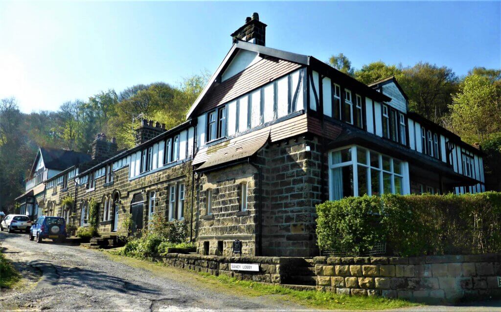
SANDY LOBBY was the route to the lower Old Pool Bank quarry, for stone and materials. On a map of 1774 this was known as Baxtongate Road and by 1823 known as Backstone Gate. This met up with Thornhill’s Road to the east, which was roughly where the A.660 now runs (Thomas Thornhill was the Pool Lord of the Manor at that time living in Creskeld Hall) It would appear to the west was Fawkes’s Road (Fawkes of Caley Hall and Farnley Hall). The deeds of some of the houses state that Sandy Lobby may only be used for quarry traffic. The stone from the quarry is sandstone. The houses were built for quarry workers c. 1870. An old hire purchase book was found under the staircase of 4, Sandy Lobby in 2000 with calendars for 1887 & 1888 and marked “Denton”. Understood from the Denton family who lived in Pool and that it belonged to Ned Denton who operated the turntable situated near the Chain Bar at the top of Old Pool Bank.

STAIRCASE LANE.
“In the days of the Regency, one of the Dyneley family after dinner and heavy gambling, on a summer evening wagered that he would gallop his horse down the Staircase. It is said he was killed and that the sound of his horses hoofs can still occasionally be heard.”
It is stated on DEFRA MAGIC that the site at the bottom end of Staircase Lane is mapped as the only uncut ancient woodland around Bramhope.
In his Descriptive Guide around Otley published around 1900 Edmund Bogg wrote: The “Staircase”, an old pack-horse way down to Pool, bordered and shaded by many fine old trees. It is a lovely spot to wile away a summer hour on – “a walk for lovers made.”
Also known as The Staircase, and Bramhope Road in 1700. Names of medieval ways down steep banks often included the word “stair”. This lane runs from Pool to Bramhope Puritan Chapel, (built c.1649) and originally was the only way through Pool to Bramhope, Cookridge and on to Leeds before the building of Pool Bank New Road in 1816 and the later Leeds Road . This is a classic “hollow way” in that it shows how much wear the lane has taken through the centuries. “Towards the south of the village, in the vicinity of Swallow Close, earthworks have been detected from aerial photographs that represent a medieval or post-medieval hollow way and bank. This area now lies under modern housing and gardens and may represent the old road into Pool from the south. Narrow ridge and furrow earthworks dating to the post-medieval period have also been identified in this area and to the west of the village” (West Yorkshire Archaeology Service, 2009.) The Lane ran straight down the gully, from Bramhope to Pool and separated at Hardy’s Lair, where there was a house and a barn. This was just below the old railway line. One track named Ribbon Lane in 1756 (see written upside down on the above map of 1756)ran at right angles to emerge opposite the bottom of Old Pool Bank. The other track ran straight down towards the river. The remains of the Hardy’s Lair barn were still evident prior to the building of the estate by Redrow in 2001. The County Council last resurfaced Staircase Lane in 1921. It’s bad state of repair was reported to P.P.C. in March 1946. In March 1966 it was confirmed to P.P.C that it was a “County Road” by the County Engineer and Surveyor. It was still classed by Leeds City Council as a public road in 2016 and called Staircase Lane. By 2020 the Lane was just a stony track and was no longer to be described a road and the old bridge was to be replaced. In 2023 repairs to the bridge were completed. As a consequence it is no longer regarded as a public road but is now a Public By-way and “it is recorded as a publicly maintainable highway” (Leeds Pathways Officer.)
The Lane would be used to carry cloth too and from Walk Mill, “In 1680 Cloth was woven and taken to Esholt, Pool, Baildon, Arthington and Harewood to be fulled or milled.”
Contents sale of Pool House in 1822 suggest it was originally named The White Hart pub and it would catch all passing cloth bearers. The Monks of Kirstall would have used this road whilst collecting dues from their various granges in the area. Also cattle, sheep, horses, carts and traps. etc. would be taken down, some en route to Otley market (established in 1222) A detector was taken on to Redrow land in October 2000 but only found remains of lots of old farm machinery and a 6d. and three penny bit both dated 1960, probably from when the Arthington Show was held there.

( Stephen Compton)
Staircase Lane was still in regular use in the 1930/40’s when people would run/walk up to catch a bus run by Ledgards of Otley. The bus ran from Otley to Leeds, with the fare cheaper than at the top of Old Pool Bank! In 1911 on Pool Feast Day a friend of Alice Davey was born and her friend’s father had to run up Staircase Lane to fetch the midwife from Bramhope.
The official address for Firs Hill Court together with Firs Hill Lodge stables (now a house) is Staircase Lane. A Roman gold coin of Valentinian I dating to 364-375 AD was found just below the surface of a rockery, in excellent condition, in the garden of Firs Hill Court in 4th Sept. 1957. Monument No. 51664 (Cartwright Memorial Hall Museum Bradford)